
June 30, 2017
Yesterday, while working with Adam on SV Bravo to try to get satellite images to display on his iPad, he showed me a website called VentureFarther. Wow, I’m impressed!
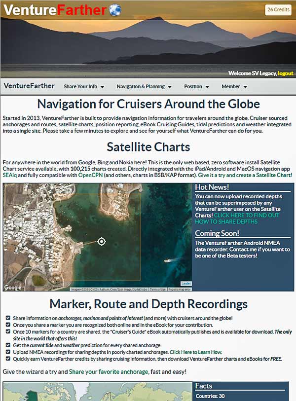
I’m not a Mac guy, but I’m often asked to help those of the Mac persuasion. I know that an iPad app called SEAiq will display satellite charts (KAP files) as charts, but I didn’t know how to get the KAP files onto the Mac. (I’m really afraid of iTunes! I know Steve Jobs is gone, but I’m pretty sure he still wants to delete all my MP3 files!). After a little setup, VentureFarther will make both creating the charts and getting them onto the iPad as simple as a couple of clicks. Us PC types aren’t left out either. You can very easily create and download satellite images and use them in programs like openCPN.
Some Details: Signing up is free. When you do, you get some credits. Each chart you download costs a credit. You get credits for sharing anchorages, routes, position reports and more. You can also subscribe for about $20 a year, which gives you unlimited credits.
VentureFarther is also a cruising community site where you can share routes, waypoints, your position and much more. Besides satellite images, there is a bunch of very useful information available including world tide tables, weather info and free guide books.
This site is created by members of the cruising family – Jon and Heather on Evergreen and they’ve done a brilliant job! Thanks Jon and Heather. -Rich


