September 19, 2013
Rich checked the weather and Houston, we had a problem. We were in for a windy spell, and in spite of how well protected our anchorage seemed, the winds would affect us. The problem was that wind tended to gust through this area while the current just sort of swirled around, leaving Legacy facing in any number of directions. This was not an issue in light winds, but with heavier gusts we’d probably end up all over the anchorage, not something we’d want with all the coral bommies around, nor did we want to end up beam-on to the gusts.
Rich had thought about going to a different spot, but I was already attached to this one and really wanted to stay. The solution: a stern anchor!
It was already gusty enough to make this job difficult–we were using the dinghy to pull the boat’s stern over and would make progress only to have a gust of wind stubbornly knock it back. But we kept at it and made progress in this tug-of-war with nature. Finally we succeeded in setting the stern anchor (and boat) just where we wanted them. We then pulled the boat back towards shore and out of the channel of wind blowing through the middle of anchorage. Suddenly it was calm and smooth, Legacy sitting nicely. We were ready now for whatever nature planned to throw at us over the coming days (uh, within reason).
Later in the afternoon conditions calmed and we decided to head out and do some exploring. Unfortunately we had an unpleasant new ritual whenever we used the dinghy: the struggle to get our electric outboard engine started. It would begin with the worrisome efforts to get it working, followed by relief when Rich finally got it started, then fear that this could well be the last time it would run. Not having a dinghy engine here would be a disaster as we had so much exploring to do, way too much ground to cover for rowing.
Below, an interactive map with a few of the places we’d end up visiting over the coming week, most of them more than once. Unfortunately, the satellite image is blown out for part of the area, so I’ve just marked favorite areas on our side of the channel. We’ll put in a map showing other areas when they become relevant.
I’ve decided to focus coming blog posts on particular places we saw during our time here; so the photo galleries will feature pictures from various days and different cameras. The changing light could have a huge effect on the look and feel of these places; so the same place can look remarkably different depending on when the photo was taken. The names I’ve mentioned aren’t official; I’m pretty much making them up as I go along.
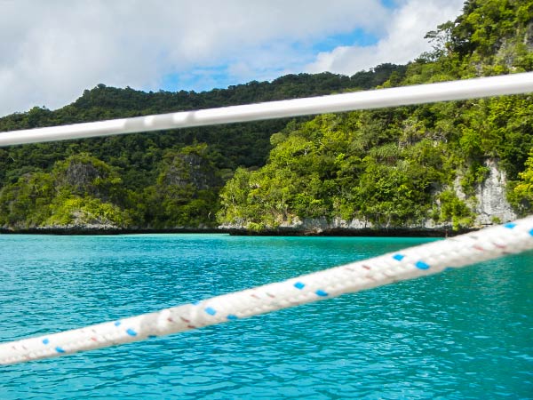
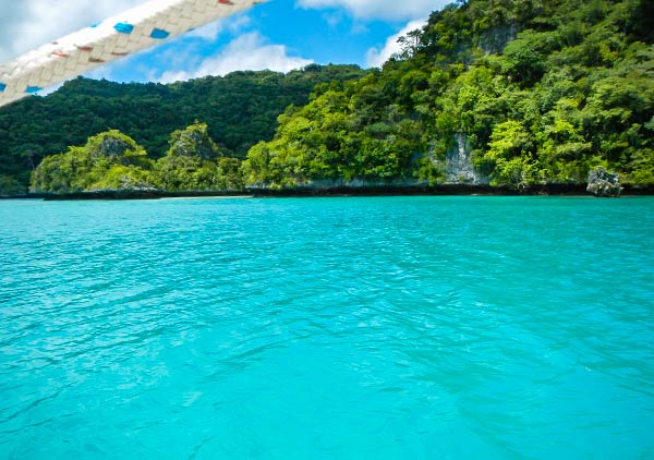
Below, just because this is as good a place as any to put them, are a couple of views out a porthole in our boat. It’s pretty cool to look out and see a scenes like this filling the view space. –Cyndi