
September 25, 2013 in Mbvatu Bay, Vanua Balavu, Fiji
I guess a boat is really one of the original off-road vehicles, though ideally only traveling on the water. According to our Navionics electronic charts, Legacy is doing some land-cruising here in Vanua Balavu. On the picture below, the yellow areas are land. The blue line is the track showing where Legacy’s been. According to this, right now, we’re anchored on a mountain.
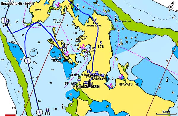
Our charts are about ½ mile off here and it’s very distracting as we motor around the island. I guess I can’t whine about it too much… just 10 years ago, it was rare for a small sailboat to have a chartplotter at the helm. In Vanua Balavu, we’re back to doing things like they did in the last millennium!
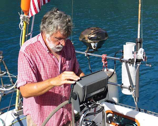
This sorry chart situation is giving me the opportunity to see a bit more. Cyndi always jokes that I should look up once in a while and enjoy the view. Here’s my usual stance behind the wheel.
Actually, our charts have been pretty good, or at least OK, for most of Fiji and only off to this extent in Vanua Balavu. Fortunately, we now have another tool – Google Earth images.
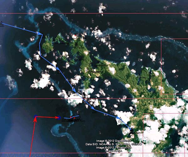
There are a couple of ways to download Google Earth images and a couple of navigation programs to display them. The above is displayed in a wonderful, free, open-source navigation program called openCPN. Since it’s on our computer and not at the helm, we use it mostly for planning – as another source of data to check our waypoints and routes. It’s also a great way to check the accuracy of charts. If the charts don’t line up with the satellite picture, something’s wrong. Sometimes it can be a little hard, or impossible, to find images without clouds of your areas of interest, but using the historical data that Google gives us access to in Google Earth, we’ve done pretty well.
Next season, I think we’ll make sure we have a windows tablet computer with a built-in gps and a waterproof case to run openCPN at the helm (it doesn’t run on the iPad). In my opinion, Google Earth images represent a major change in the way we navigate. I think in a few years, it will be very rare for anyone to voyage without consulting the satellite imagery. Viva technology (when it works!). -Rich
Update: February 2016
Just a couple of notes:
- The Google satellite images for this area have gotten much better. I used to be hard to find images without clouds. It’s pretty easy now, selecting from among the images in View/Historical Imagery.
- I’ve been using a $100 program called ChartAid recently to capture satellite images. For me, it’s easier than GE2KAP.
- SAS Planet is also a good alternative. With it, you can cache images to use offline. You can also use GE2KAP to grab those images, make KAP files and use them in OpenCPN.
- We didn’t get a Windows tablet. Instead, we’re using OpenCPN on our Android phone (the $10 paid version vs. the free version).
Update, January 2017
Here in Australia, we’re finding serious errors in the depths depicted on both Navionics standard charts as well as on their SonarCharts. More here.


