
December 27, 2016
A while back, we posted this picture on the page about our plans showing what we thought our future might look like. It was mostly a joke, hastily drawn in crayon. But as time went on, we realized that it was more accurate than we expected.
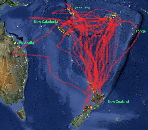
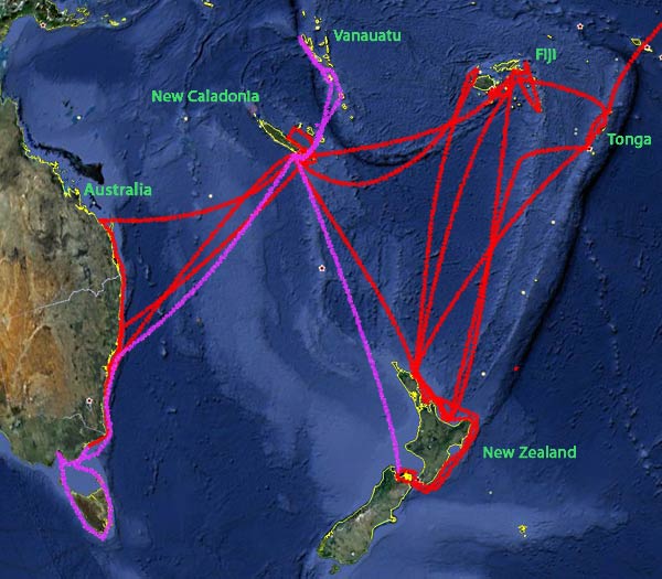
Below is the real deal, carefully drawn with our set of Crayola navigational plotting crayons (part no. CR 2324/nav). It shows what we’ve done (red) and what we hope to do in the near future (purple).
Pretty similar, huh?
Beyond the purple line plan is at least one more trip to the tropics from New Zealand and then who knows? Great Barrier Reef? Palau? Indonesia? Only time will tell. For now, we’re loving this area we call the cul-de-sac.
-Rich


