
![]() We posted a Google map of the Tauranga and Mt. Maunganui area showing our favorite eats and resources.
We posted a Google map of the Tauranga and Mt. Maunganui area showing our favorite eats and resources.
Month: February 2014
Waiheke Island – EYCEWTN
![]() EYCEWTN: everything you could every want to know. Cyndi’s done it! Her majorly comprehensive guide to Waiheke Island, including an interactive Google map with lots of links, is ready!
EYCEWTN: everything you could every want to know. Cyndi’s done it! Her majorly comprehensive guide to Waiheke Island, including an interactive Google map with lots of links, is ready!
This kicks off our new “Cruising Info” page where we hope to put lots of these interactive maps and equipment reviews.
Just select “Cruising Info” from the menu at the top of this page. Or click here.
Great Excitement in the Mail
February 17, 2014 in Tauranga
Awaiting us upon our arrival were two, brand new, shiny, New Zealand driver’s licenses.
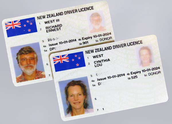
Our California licenses were about to expire and that was a bit of a problem since we had no plans to return to the states in the near future. New Zealand stepped in and solved our problem with these NZ licenses good for 10 years! All we had to do was to complete a form and pay $57 each. No tests! Thank you New Zealand – I’m so excited! -Rich
We’re in Tauranga – Early!
February 17, 2014
We thought we’d stay out and cruise for another week but this is the weather forecast we saw last night…
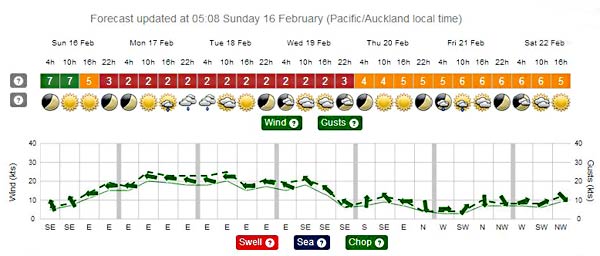
We were at Great Mercury Island and with the direction and strength of the forecast winds, we’d have to hang there until Thursday before we could resume cruising. That turned out to be just a little too long for the slightly barn-sour crew of Legacy, so off we went, through the night until we saw this sight early in the morning…
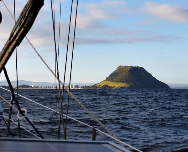
Now we’re safely tucked in to the marina and have already had our first Hamburger! It feels great to be HOME. That’s right, I said “home.” I think Tauranga feels most like home to me now, even over California, where I spent most of 54 years.
Life is good, both out there exploring and tied up next to a city. -Rich
Distance Perception Problem
February 15, 2014 (but it could be any day)
We pulled in to Coralie Bay on New Zealand’s Great Mercury Island this afternoon and anchored. I had my usual problem: I felt like I was too close to the boat that was already here, while my instruments said I was just fine.
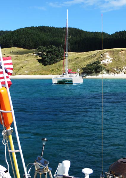
I really have trouble judging distance from the deck of our boat so I use our chartplotter and (incredible) Simrad 4G radar to measure distances when anchoring.
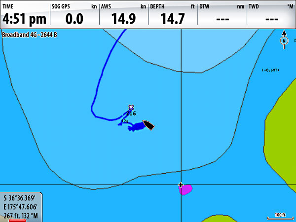
The electronics said I was 267 feet away. Wow, it didn’t look it. It got me curious: How many Legacys would fit between us?
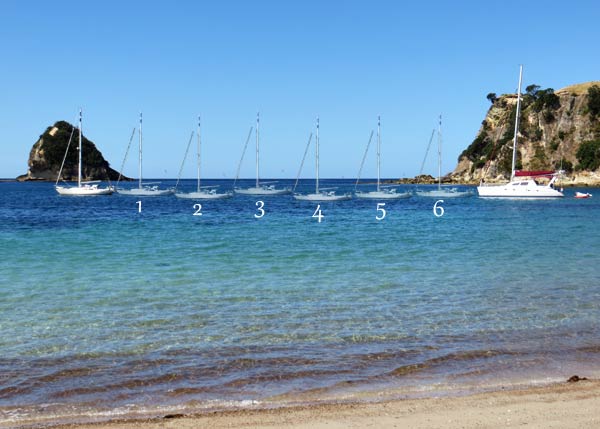
The answer, by my less than scientific photoshop method, on a photo taken from the incredible beach surrounding us, is six. Let’s see… 6 x 38… round off to 40… equals 240 feet. Enough room. Why can’t I calibrate my eyeballs to make more accurate measurements? -Rich